
Canon GPS Receiver GP-E2


Canon GPS Receiver GP-E2
Product details
- Rugged Lightweight Design
- Location Information in EXIF File
- Can Act As Stand-Alone GPS Logger
- On-Board Electronic Compass
- Hot Shoe or USB Terminal Connectivity
- Runs on Convenient AA Batteries
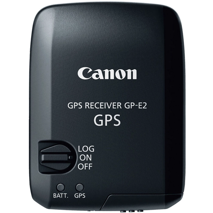
Canon 's GPS Receiver GP-E2 records GPS information like longitude, latitude, elevation, direction and Universal Coordinated Time (UTC) as EXIF data on photo files using a compatible EOS camera. This lightweight, compact unit can also serve as an electronic compass or a stand-alone GPS recorder. It was designed specifically for the EOS system, and offers USB and hot-shoe connections with the EOS 5D Mark III and the EOS-1D X (USB connection-only with the EOS 7D). It's also compatible with the Rebel T5i via USB, and with the EOS Rebel T4i and Rebel SL1 via the Digital terminal on each camera.
The GP-E2 offers the same level of dust- and weather-resistance as the EOS 5D Mark III camera when connected to the camera's hot-shoe. Dust- and weather-resistance decreases when it's connected to the camera via the USB cable. For simple and accurate recording of time and location information, the GP-E2 is an ideal complement to the EOS System.
The EOS 5D Mark III and EOS 7D require a firmware upgrade to be compatible with the GPS Receiver GP-E2.
When the EOS 7D is used with the GP-E2 the following restrictions will apply: a) geotagging function will not work for movies while recording; b) geotagging features will not work for movies when using the Map Utility; c) electronic compass information and automatic time setting is not available; d) transmission via the hot shoe is not possible .
| Data | Records location information (longitude, latitude, elevation, direction, and universal coordinated time (UTC)) as EXIF information to images when shooting |
| Attachment Method | Attaches to camera's USB port, hot-shoe or Digital terminal |
| Frequency | Reception: 1575.42 MHz (L1 band) |
| Positioning | Intervals: Every 1, 5, 10, 15, or 30 sec, or every 1, 2, or 5 min |
| Reception | Satellite: Shown on the GPS indicator (red) Before signal acquisition: Fast blinking Signal acquired: Slow blinking |
| Compass | Direction-calculated using a triaxial geomagnetic sensor and triaxial acceleration sensor |
| Logging | Intervals: Every 1, 5, 10, 15, or 30 sec, or every 1, 2, or 5 min Log File Format: NMEA-0813 File Usage: Images can be geotagged using Map Utility with log files Log files can be converted to KMZ files using Map Utility. Routes the camera has traveled can be viewed in Google Earth or other map software by loading the KMZ files |
| Modes | Power Switch set to On: Location information (latitude, longitude, altitude, direction, and UTC time) is automatically added to images as EXIF information when taking pictures Power Switch set to LOG: Location information (latitude, longitude, altitude, and UTC time) is recorded on GPS Receiver GP-E2 at the specified interval Location information (latitude, longitude, altitude, direction, and UTC time) is automatically added to images as EXIF information when taking pictures Connected to a Computer: Supports the following operations when GPS Receiver GP-E2 is connected to a computer and Map Utility is used to access GPS Receiver GP-E2's log files: Import logs to the computer Delete logs Manually geotag shots without GPS information by adding location information (latitude, longitude, altitude, and UTC time) to image as EXIF information View a route of where the camera has traveled on a map Produce KMZ files from log files Update EOS 7D firmware |
| Time | Set GPS time data on the camera (requires signal acquisition from 4 or more satellites) Clock Precision: High-precision time adjustment: ±TBA sec Margin of error relative to UTC time High-precision time adjustment is only available for EOS-1D series cameras (EOS-1D X or later) Normal time adjustment: ±1 sec Updating Interval: Auto update: After satellite reception when the GPS Receiver is turned on Immediate updating |
| Interface | Hot shoe for direct connection to camera Digital port for connection via dedicated interface cable Transmission via cable used if GPS receiver is attached to hot shoe and connected via cable |
| Power Supply | 1x AA LR6 alkaline battery Battery life at each position update interval: At normal temperature (73°F (23°C)): 1 sec: 10 hr 5 sec: 27 hr 10 sec: 37 hr 15 sec (default): 39 hr 30 sec: 39 hr 1 min: 54 hr 2 min: 63 hr 5 min: 92 hr Battery Check: Indicated by the battery check lamp (red) Level OK: Slow blinking Low battery: Fast blinking Replace battery: Off |
| Operating Temperature | 32 to 104°F (0 to 40°C) |
| Operating Humidity | 85% or less |
| Dimensions (W x H x D) | Approx. 2.1 x 2.9 x 1.7" (5.43 x 7.29 x 4.42 cm) |
| Weight | Approx. 2.86 oz (81 g) |
| Packaging Info | |
|---|---|
| Package Weight | 1.0 lb |
| Box Dimensions (LxWxH) | 7.0 x 6.2 x 2.7" |
- Storage Case
- Carrying Case
- 9.8" / 25 cm Cable
- 4.9' / 1.5 m Cable
- Software Disc
- 1-Year Limited Warranty
Product details
- Rugged Lightweight Design
- Location Information in EXIF File
- Can Act As Stand-Alone GPS Logger
- On-Board Electronic Compass
- Hot Shoe or USB Terminal Connectivity
- Runs on Convenient AA Batteries
Canon 's GPS Receiver GP-E2 records GPS information like longitude, latitude, elevation, direction and Universal Coordinated Time (UTC) as EXIF data on photo files using a compatible EOS camera. This lightweight, compact unit can also serve as an electronic compass or a stand-alone GPS recorder. It was designed specifically for the EOS system, and offers USB and hot-shoe connections with the EOS 5D Mark III and the EOS-1D X (USB connection-only with the EOS 7D). It's also compatible with the Rebel T5i via USB, and with the EOS Rebel T4i and Rebel SL1 via the Digital terminal on each camera.
The GP-E2 offers the same level of dust- and weather-resistance as the EOS 5D Mark III camera when connected to the camera's hot-shoe. Dust- and weather-resistance decreases when it's connected to the camera via the USB cable. For simple and accurate recording of time and location information, the GP-E2 is an ideal complement to the EOS System.
The EOS 5D Mark III and EOS 7D require a firmware upgrade to be compatible with the GPS Receiver GP-E2.
When the EOS 7D is used with the GP-E2 the following restrictions will apply: a) geotagging function will not work for movies while recording; b) geotagging features will not work for movies when using the Map Utility; c) electronic compass information and automatic time setting is not available; d) transmission via the hot shoe is not possible .
| Data | Records location information (longitude, latitude, elevation, direction, and universal coordinated time (UTC)) as EXIF information to images when shooting |
| Attachment Method | Attaches to camera's USB port, hot-shoe or Digital terminal |
| Frequency | Reception: 1575.42 MHz (L1 band) |
| Positioning | Intervals: Every 1, 5, 10, 15, or 30 sec, or every 1, 2, or 5 min |
| Reception | Satellite: Shown on the GPS indicator (red) Before signal acquisition: Fast blinking Signal acquired: Slow blinking |
| Compass | Direction-calculated using a triaxial geomagnetic sensor and triaxial acceleration sensor |
| Logging | Intervals: Every 1, 5, 10, 15, or 30 sec, or every 1, 2, or 5 min Log File Format: NMEA-0813 File Usage: Images can be geotagged using Map Utility with log files Log files can be converted to KMZ files using Map Utility. Routes the camera has traveled can be viewed in Google Earth or other map software by loading the KMZ files |
| Modes | Power Switch set to On: Location information (latitude, longitude, altitude, direction, and UTC time) is automatically added to images as EXIF information when taking pictures Power Switch set to LOG: Location information (latitude, longitude, altitude, and UTC time) is recorded on GPS Receiver GP-E2 at the specified interval Location information (latitude, longitude, altitude, direction, and UTC time) is automatically added to images as EXIF information when taking pictures Connected to a Computer: Supports the following operations when GPS Receiver GP-E2 is connected to a computer and Map Utility is used to access GPS Receiver GP-E2's log files: Import logs to the computer Delete logs Manually geotag shots without GPS information by adding location information (latitude, longitude, altitude, and UTC time) to image as EXIF information View a route of where the camera has traveled on a map Produce KMZ files from log files Update EOS 7D firmware |
| Time | Set GPS time data on the camera (requires signal acquisition from 4 or more satellites) Clock Precision: High-precision time adjustment: ±TBA sec Margin of error relative to UTC time High-precision time adjustment is only available for EOS-1D series cameras (EOS-1D X or later) Normal time adjustment: ±1 sec Updating Interval: Auto update: After satellite reception when the GPS Receiver is turned on Immediate updating |
| Interface | Hot shoe for direct connection to camera Digital port for connection via dedicated interface cable Transmission via cable used if GPS receiver is attached to hot shoe and connected via cable |
| Power Supply | 1x AA LR6 alkaline battery Battery life at each position update interval: At normal temperature (73°F (23°C)): 1 sec: 10 hr 5 sec: 27 hr 10 sec: 37 hr 15 sec (default): 39 hr 30 sec: 39 hr 1 min: 54 hr 2 min: 63 hr 5 min: 92 hr Battery Check: Indicated by the battery check lamp (red) Level OK: Slow blinking Low battery: Fast blinking Replace battery: Off |
| Operating Temperature | 32 to 104°F (0 to 40°C) |
| Operating Humidity | 85% or less |
| Dimensions (W x H x D) | Approx. 2.1 x 2.9 x 1.7" (5.43 x 7.29 x 4.42 cm) |
| Weight | Approx. 2.86 oz (81 g) |
| Packaging Info | |
|---|---|
| Package Weight | 1.0 lb |
| Box Dimensions (LxWxH) | 7.0 x 6.2 x 2.7" |
- Storage Case
- Carrying Case
- 9.8" / 25 cm Cable
- 4.9' / 1.5 m Cable
- Software Disc
- 1-Year Limited Warranty


